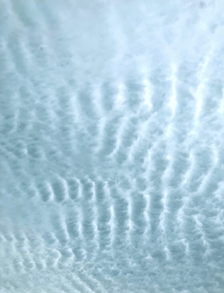

This image was taken November 12th at 8:50 am. I speculate that they are Altocumulus Undulatus because they are long, puffy and stacked. I believe the atmosphere was stable.
Cirrus Floccus and Cirrocumulus Clouds in Boulder, Colorado
Cooper Wyrick
Clouds Second
MCEN 4151-001
Altocumulus Undulatus Clouds
November 12, 2025 at 8:46 a.m.
Engineering Center, Boulder, Colorado
This image was created for the Clouds Second assignment in MCEN 4151. The purpose of the assignment was to photograph a view of clouds and connect it to the underlying physics. My intent for this image was to capture an interesting cloud formation, especially one that displayed a repeating pattern. I had taken several photographs of different cloud types earlier in the semester, but this image stood out because of the wave-like structure across the sky.
The photograph was taken at the Engineering Center at CU Boulder while I was standing on the concrete and pointing the camera directly upward. The image was captured on November 12, 2025 at 8:46 a.m. when the lighting and sky conditions made the patterns easy to see. The camera was oriented straight up, which helped emphasize the structure of the clouds rather than the horizon.
Based on their appearance, the clouds in the image are Altocumulus Undulatus. The entire sky looked consistent, with long, parallel, puffy worm-like bands. Weather data supports this identification. On the day before the image (November 11), Boulder’s high was 70°F and the low was 45°F. On November 12 the temperature ranged from 41-59°F; and on November 13 it rose again to 46-73°F (“Boulder, CO”). The figure below shows the nearest Skew-T (“Upperair Air Data.”).
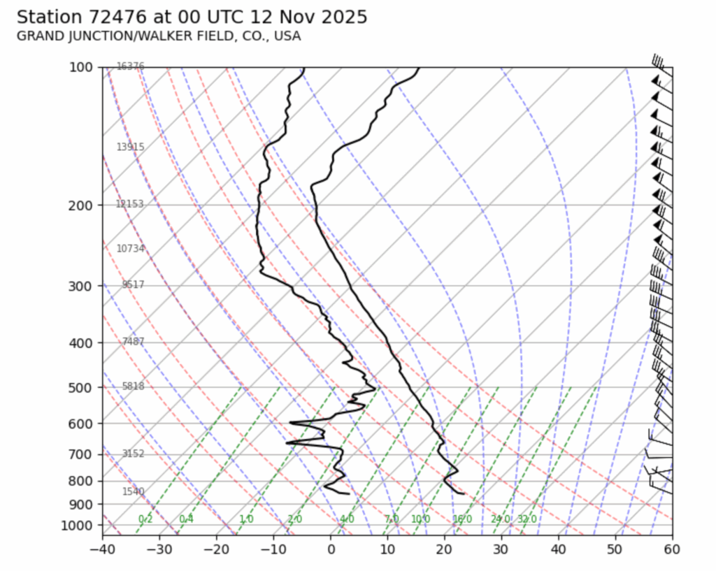
Figure 1: Nearest Skew-T Plot
The lack of precipitation indicated relatively stable weather conditions. During the observation, winds were calm and there was no rain or snow before or after the image was taken. The stability of the atmosphere aligns with the formation of Altocumulus Undulatus because they form when stable layers experience gentle oscillations. Cloud heights would be expected around 2-6 km above ground level. This agrees with the ceilometer data from Skywatch Observatory, which reported cloud bases near 6 km (Skywatch Observatory).
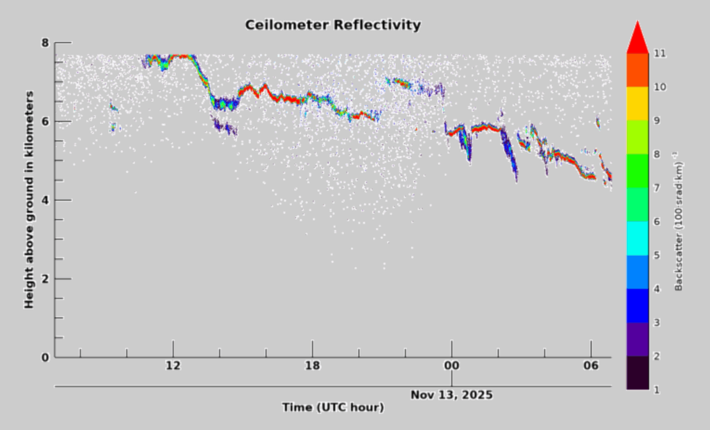
Figure 2: Ceilometer Map from CU Boulder November 12, 2025
The physics behind this formation comes from wind shear and small movements within a cloud layer, causing parcels to rise and fall in waves.
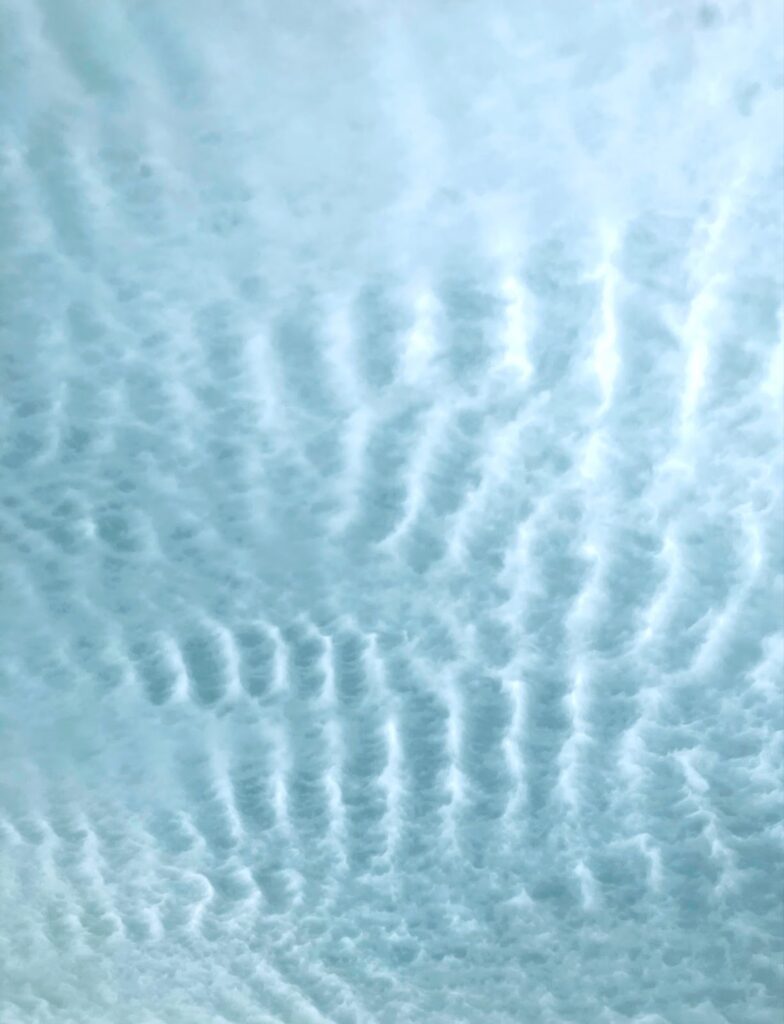
The photographic technique also played a role in how the final image appears. I used an iPhone SE (3rd generation), a digital camera with a 3.99 mm focal length lens. The original image size was 3024 x 4032 pixels, and the final cropped version is 2822 x 3686 pixels. The exposure settings were f/1.8 at a shutter speed of 1/1056 sec. The ISO was 40. For post-processing, I used the Colourtone app to increase the contrast and reduce the color temperature so the cloud patterns stood out more clearly against the sky. Below is the original image.
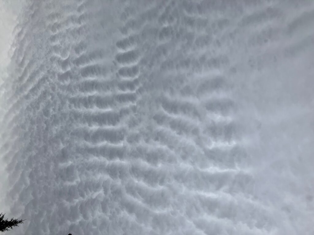
Figure 3: Original Photograph of Clouds
Overall, the image highlights the wave-like structure characteristic of Altocumulus Undulatus clouds. I like how the contrast and upward-facing composition emphasize the repeating pattern across the entire frame. The image shows the fluid physics associated with atmospheric wave motions in a stable environment. One thing I would improve next time is photographing more of the surrounding sky or including multiple angles to show how widespread the formation was. I fulfilled my intent to photograph a visually distinctive cloud phenomenon, and future work could include exploring similar wave structures at sunrise or sunset, times when light scattering might enhance the texture even more.
Appendix
“Boulder, CO Monthly Weather.” AccuWeather, www.accuweather.com/en/us/boulder/80302/november-weather/327347. Web. Accessed 1 Dec. 2025.
Skywatch Observatory. Skywatch. University of Colorado Boulder, n.d. Web. Accessed 1 Dec. 2025.
“Upperair Air Data.” Wyoming Weather Web, University of Wyoming, weather.uwyo.edu/upperair/sounding.shtml. Web. Accessed 1 Dec. 2025.