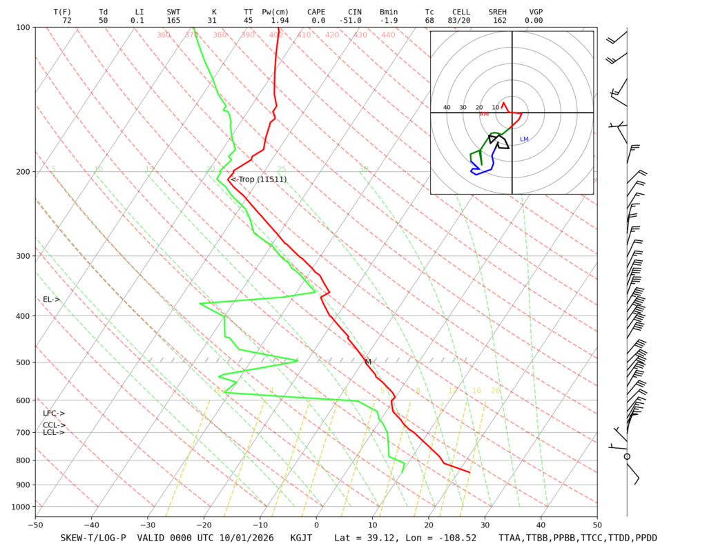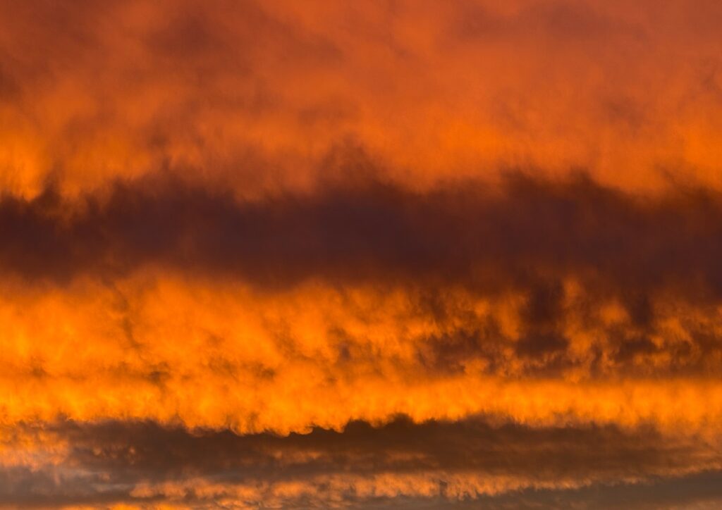
This image was captured at 6:49PM MST on September 30, facing due west, from the junction of South Boulder Creek and the BNSF Front Range Subdivision 476 rail track. See below for a Skew-T plot from Grand Junction at 5:00PM MST.
The cloud types in this image are stratocumulus, likely caused by the inversion at 600 millibar clear in the sounding below, and a lower and very small band of fluctus visible about 1/4 of the way up from the bottom of the image at around 750-700 millibar, corroborated by the wind shear present in the sounding at those altitudes. From the sounding, it is clear that the atmosphere is stable in the cloud-forming region.