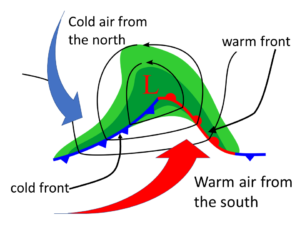
Why use a term with a clear meaning like ‘terrain-induced’ when you can use something obscure like ‘orographic’? Well, you can save four letters and a hyphen and break brains in the process. Bonus!
Orographic means ‘related to mountains’ and comes from the Greek word for hill, ‘oros’. Air moving over mountains is pushed up and over by the terrain, creating different clouds as it is forced up, over, and down the other side. Here in Boulder, Colorado we have a great view of clouds generated above the Rocky Mountains. In the summer, the atmosphere is mostly unstable, and the upwards push of the mountains triggers thunderstorms that develop any time the air is moist enough. This often happens in mid- to late-summer, and we call this our ‘monsoon’. Thunderstorms form over the mountains and then move out to the east, over the plains.

At other times of year, when the air is stable, we get very different clouds, most notably the altocumulus standing lenticularis (ACSL) , as shown in Figure 1. Lenticularis refers to the ‘lens’ or ‘lentil’ shape. This cloud is also known as a ‘mountain wave’ cloud. When the air is stable, and wind comes from the west across the Rockies, it can overshoot as it comes down, descending below the optimal altitude for its density. Like a spring-mass-damper system, it bounces back up, overshooting again by going too high. The bounce repeats, often in a diminishing series of bounces, like ripples on a pond, also known as gravity waves . These are common here on Earth, unlike Einstein’s gravitational waves . At the top of each bounce, the air is cool enough to condense into a narrow band of cloud. Depending on wind conditions, the wave may be ‘standing’, with the peak remaining in the same place for hours, or may move off downstream with new peaks forming behind it; either way, we would still call it ACSL.

ACSL clouds may have smooth edges, as in the classic lenticular shape, with a lentil- or lens-shaped cross-section, or it may look more turbulent and roughed up. But it probably won’t look like altocumulus clouds formed by unstable air, with their flat bottoms and cauliflower tops.
Figure 3: Rocky Mountain Wave Clouds by D. DurrandGlider pilots love the updrafts, but this phenomenon can have devastating effects, even beyond potential plane crashes. The Marshall Fire on December 30, 2021, was a direct consequence of a mountain wave windstorm slamming down onto the plains just east of the Front Range that day, killing two people and destroying over 1000 homes .

Besides the gravity waves that lead to ACSL clouds, mountains can also cause rare fluctus, or Kelvin-Helmholtz (K-H) clouds. These form in shear layers, areas where the wind speed changes suddenly with height. Generally the increase in speed with height is gradual, but the speed can change quickly downwind of mountain ranges in stable air. The strong shear results in a layer of vorticity or rotational air, which then collects into a regular series of vortices: this is the Kelvin-Helmholtz instability . If the top of a cloud coincides with the shear layer, the rotating vortices will pull the cloud into a row of waves , as shown in Figure 4. This can happen almost anywhere in the atmosphere but is more common near mountains or on top of fog or low stratus clouds, often over bodies of water. The K-H instability is pretty common: it’s easy to study in the laboratory, occurs in the ocean, and can even be found in the sun. But having the right moisture layer at the same time is rare. These conditions are fleeting, so fluctus may last only a few seconds. Do photograph it if you see it!

Another orographic cloud that occurs in stable atmosphere is the Foehn (pronounced ‘fawn’) cloud wall that accompanies a Foehn wind . As moist air is pushed up in elevation by the terrain, it cools, condenses, and releases moisture, as shown in Figure 5. The resultant clouds are visible just over the mountains, as shown in Figure 6. When the air descends the other side, it heats quickly during compression since it has little thermal inertia compared to moister air. The clouds evaporate, leaving clear air on the leeward (downwind) side. Foehn winds are also called ‘Chinook’ winds after a group of Pacific Northwest indigenous people where the term originated. The inland Blackfoot people refer to these winds as ‘snow eaters’ since they occur in winter and are warm and dry enough to make snow sublimate .

