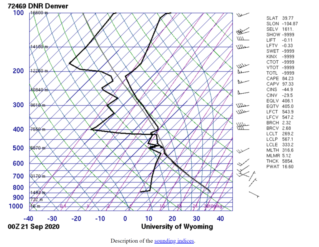
This is a photograph taken September 20th, 2020 in Thornton, CO. As indicated on the Skew-T map from the University of Wyoming, this stratocumulus cloud was formed during an unstable atmosphere.
Cloud 1// Hannah Moller
Categories
Search for content or authors
Flow Vis Guidebook
- Introduction to the Guidebook
- Overview 1: Phenomena. Why Does It Look Like That?
- Overview 2: Visualization Techniques
- Overview 3: Lighting
- Overview 4 - Photography A: Composition and Studio Workflow
- Overview 4 - Photography B: Cameras
- Overview 4 - Photography C: Lenses - Focal Length
- Overview 4 - Photography C: Lenses - Aperture and DOF
- Overview 4: Photography D: Exposure
- Overview 4 - Photography E - Resolution
- Overview 5 - Post-Processing
- Clouds 1: Names
- Clouds 2: Why Are There Clouds? Lift Mechanism 1: Instability
- Clouds 3: Skew - T and Instability
- Clouds 4: Clouds in Unstable Atmosphere
- Clouds 5: Lift Mechanism 2 - Orographics
- Clouds 6: Lift Mechanism 3 - Weather Systems
- Boundary Techniques - Introduction
- Dye Techniques 1 - Do Not Disturb
- Dye Techniques 2 - High Visibility
- Dye Techniques 3 - Light Emitting Fluids
- Refractive Index Techniques 1: Liquid Surfaces
- Refractive Index Techniques 2: Shadowgraphy and Schlieren
- Particle Physics: Flow and Light
- Art and Science
- TOC and Zotpress test
- Photons, Wavelength and Color
6 Comments. Leave new
Love the huge area this photo covers as well as the beautiful colors captured. Nice work!
I like the movement in this image, how the within the frame of the image you can see the cloud transforming.
Really nice sharpness and contrast within the clouds themselves. Great picture!
So cool going from rainy to clear skies! Great job!
I love the contrast between the dark rain clouds and the sun shining through on the left side.
I love how you captured the rain in the left side of the image. The colors work really well together as well! Great job Hannah!