NASA image by Norman Kuring/NASA’s Ocean Color Web, using Landsat data from the U.S. Geological Survey.
Image Source: https://visibleearth.nasa.gov/images/149803/the-emerald-isles-of-ha-long-bay
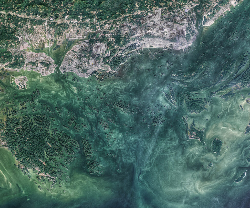
This image, from NASA’s Ocean Color Web, is of Hạ Long Bay, a 600 square mile region along the northern coast of Vietnam which is a UNESCO World Heritage site.. The region includes a wide variety of Karst formations made of limestone including pillars, conical peaks, arches and caves. The islands are home to some species which can be found nowhere else in the world [1]. According to NASA, the varying colors of the ocean could be due to sunlight interacting with various materials in the water such as phytoplankton, mineral particles, and organic matter. Highly productive oceanic regions posses a deep green color due to large amounts of phytoplankton [2]. These productive regions may be one cause of the varying shades of green within the image.
[1] https://earthobservatory.nasa.gov/images/149803/the-emerald-isles-of-ha-long-bay
[2] https://oceancolor.gsfc.nasa.gov/
2 Comments. Leave new
Third prize.
The color and the scale of nature just really speak to me with this image.
Second prize! Having all the islands scattered around the ocean cause some really cool patterns to form. It’s also interesting how something so small like phytoplankton can cause the color of something so large (the ocean) to change.