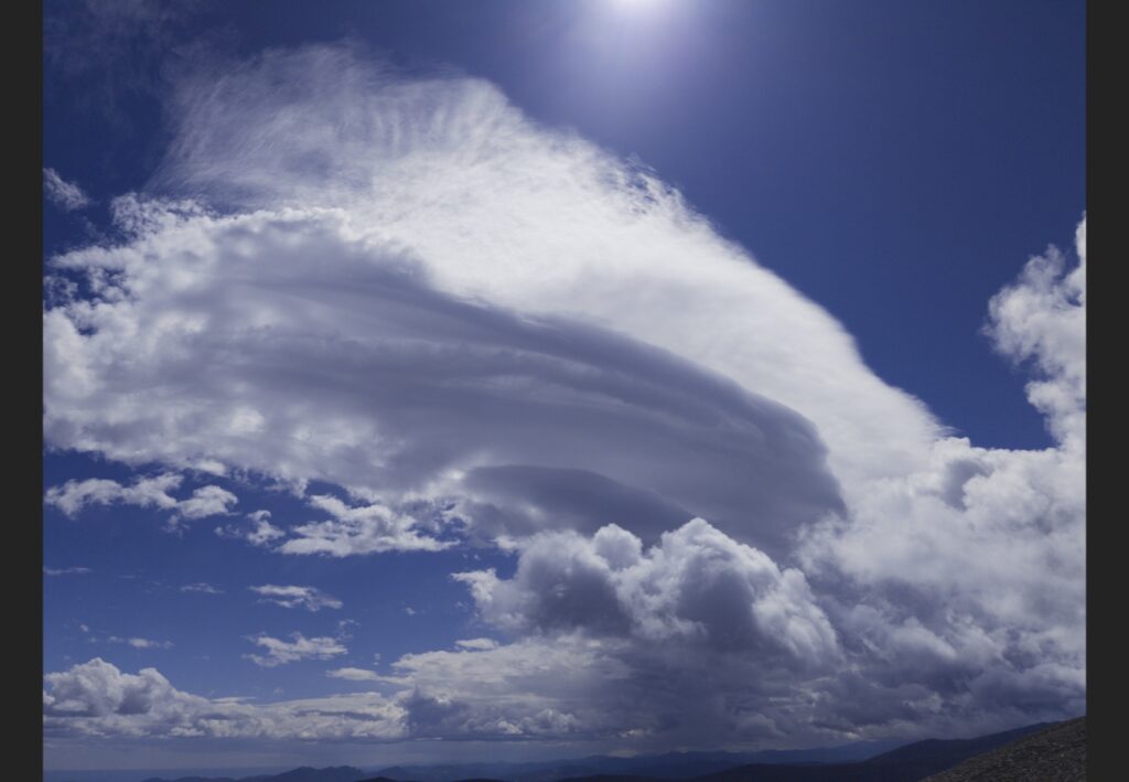
This image was taken in the Brainard Lake State Recreation area at an approximate elevation of 3715 meters above sea level. I was facing approximately south-southeast when I took this image using a Google Pixel 6A at 14:29 on September 21. The atmosphere was stable in this picture, as supported by Skew-T diagram. In this picture, low level cumulus clouds and a lenticular cloud are present. After the image was taken, the cumulus clouds present around 4000 meters expanded and started releasing sleet.
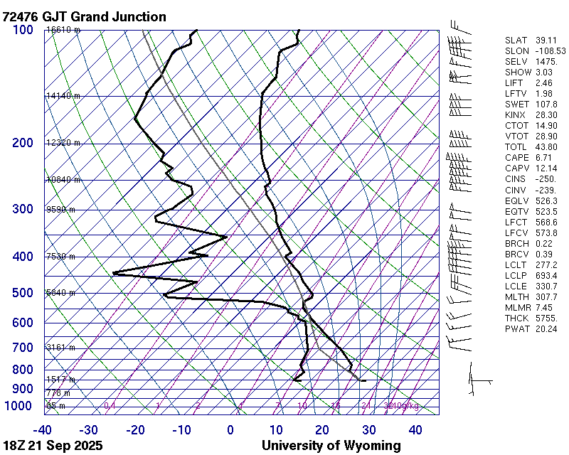
Closest Skew-T Diagram (measured at noon Mountain time)
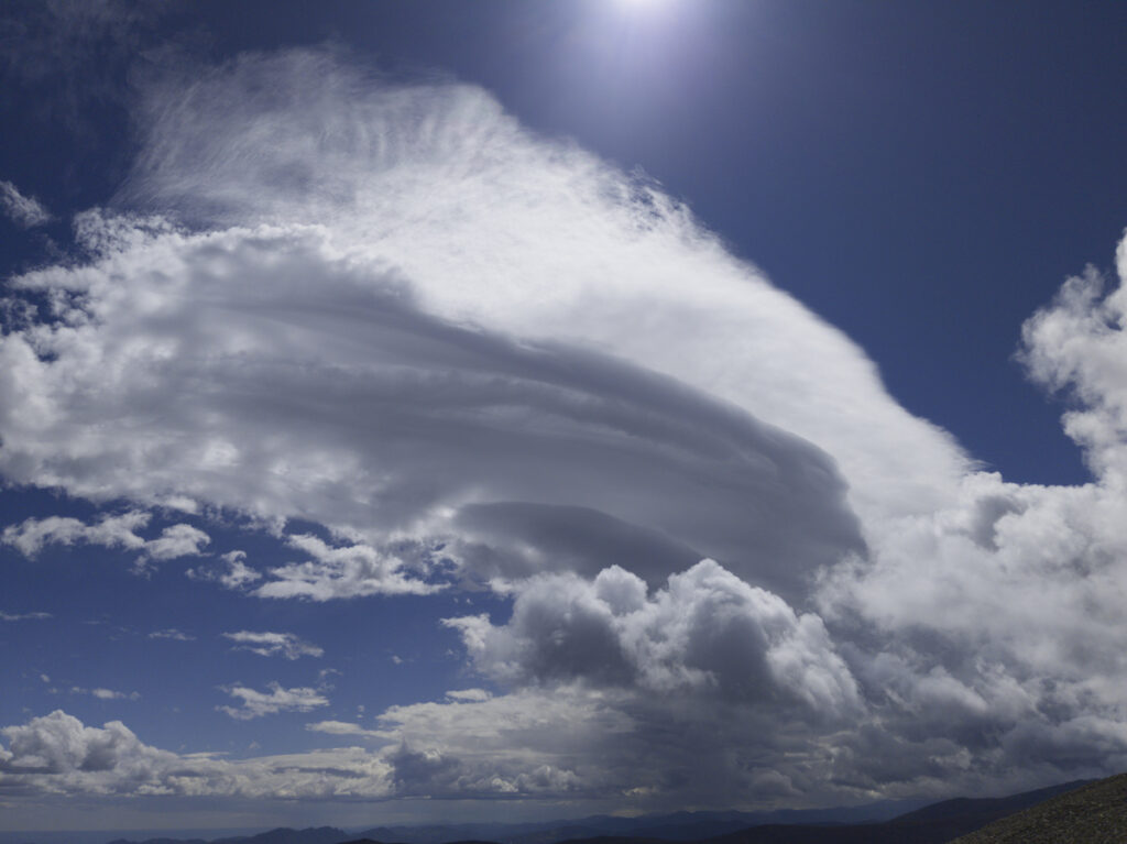
Unedited Photo (Compressed)
3 Comments. Leave new
This lenticular formation is insane, the layering looks super clean and well-defined.
Hi Luke, I think your image is particually stunning because you did a very good job of capturing the scale of this cloud. Your post processing only enhances it, and the minimal change keeps the quality I like.
Luke, I think your image really showcases the uniqueness of the lenticular cloud formation especially with the clarity and color of the blue backdrop. I really like how you included some of the mountains in the final image as well.