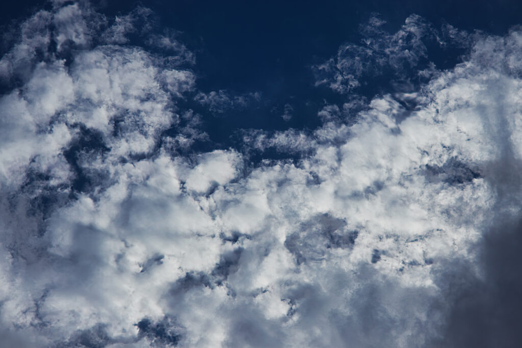
This photo was taken in Broomfield, Colorado using a Canon EOS R50 with the RF 50mm f/1.8 lens, mounted on a tripod and aimed almost straight up. Camera settings were 1/2000 second, f/5.6, and ISO 100 to preserve highlight detail and maintain contrast in the mid-level cloud texture. The framing leaves out the horizon so the focus stays entirely on the structure of the cloud layer. The goal was to isolate form, showing patchy regions of lift, soft shading, and blue sky between cells.
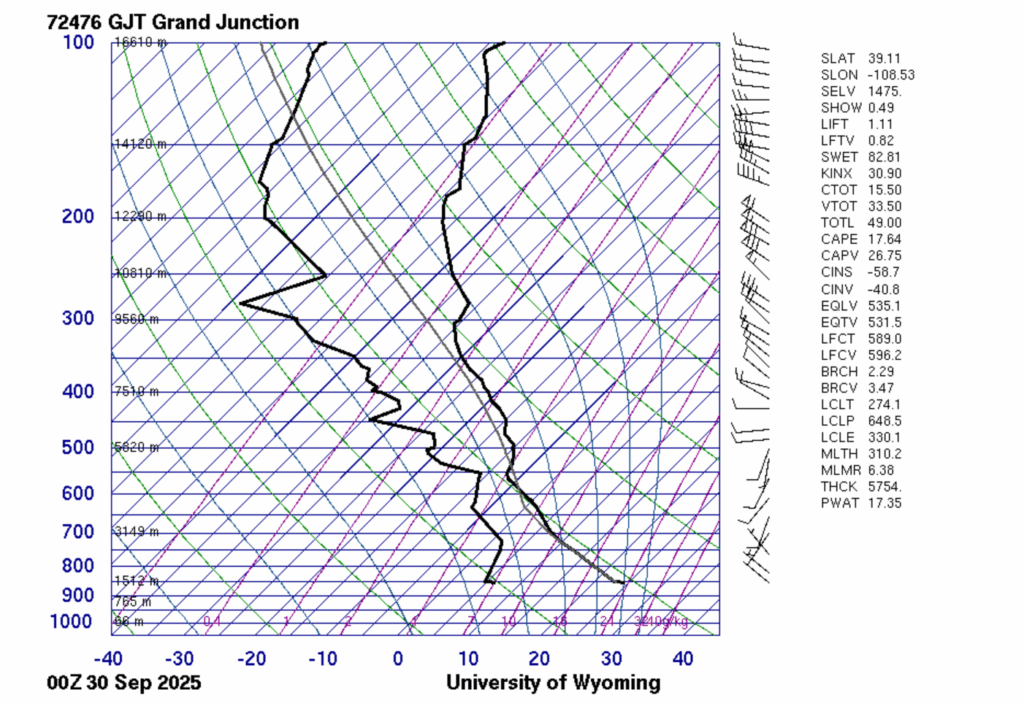
To analyze the atmosphere, I used the University of Wyoming’s Grand Junction sounding from 00Z on September 30, 2025. The temperature and dewpoint lines converge between 700 and 600 millibars, showing a saturated mid-level layer, typical of altocumulus formation. The lifted condensation level pressure (LCLP) was around 650 millibars, placing the cloud base at roughly 3 to 4 kilometers above ground. CAPE was only 18 joules per kilogram, indicating almost no buoyant energy, ideal for forming a flat altocumulus layer after earlier rain, with no further storm development. The environmental conditions were relatively stable because low CAPE meant there was little energy to fuel upward motion.
3 Comments. Leave new
I absolutely love the flat looking perspective, almost looks like water or waves crashing.
Hi Curtis, this picture reminds me a lot of foam from waves crashing in the ocean. I like how you chose the straight up angle to take this picture, and how you framed it to include the dark blue sky behind the clouds. Nice work!
This image is really fascinating because initially I couldn’t tell if you took this from above the clouds or below them! It really gives quite an interesting perspective on how the clouds are formed and how we view them, great picture!