
Swirling Skies and Melting Icebergs – NASA Science
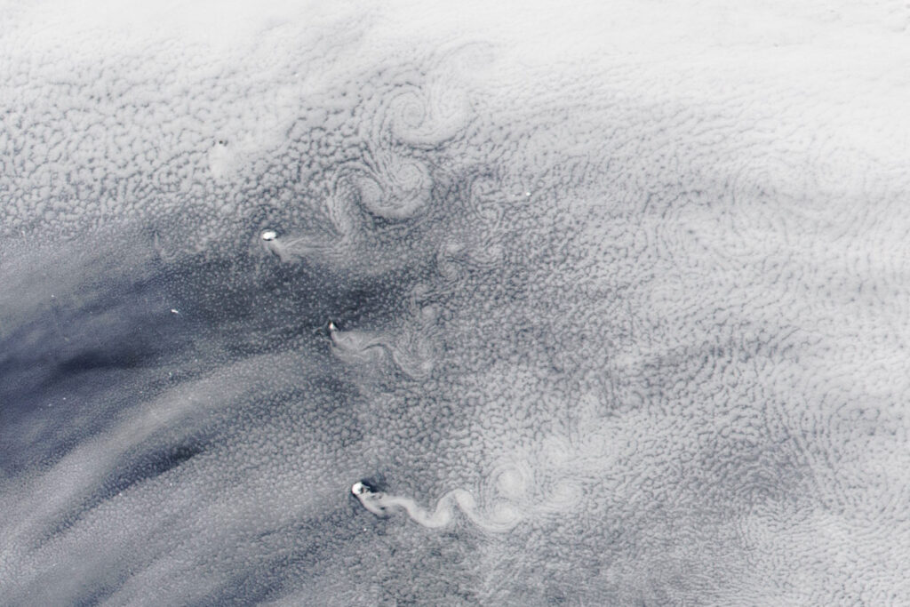
This satellite image, captured by NOAA-20 in February 2025, shows Von Karman vortex sheets forming behind the South Sandwich Islands as wind flows past the volcanos. This pattern can form when a fluid passes a tall, isolated, stationary object. I believe this is a good example of flow visualization because the swirling clouds make the movement and patterns of the air visible.
NASA Earth Observatory image by Wanmei Liang, using VIIRS data from NASA EOSDIS LANCE, GIBS/Worldview, and the Joint Polar Satellite System (JPSS)


2 Comments. Leave new
second – satellite shots showing things you wouldn’t be able to see normally are cool
Third Prize- These satellite shots of natural occurrences on Earth fascinate me, and seeing such a particular phenomena on such a large scale is incredible.