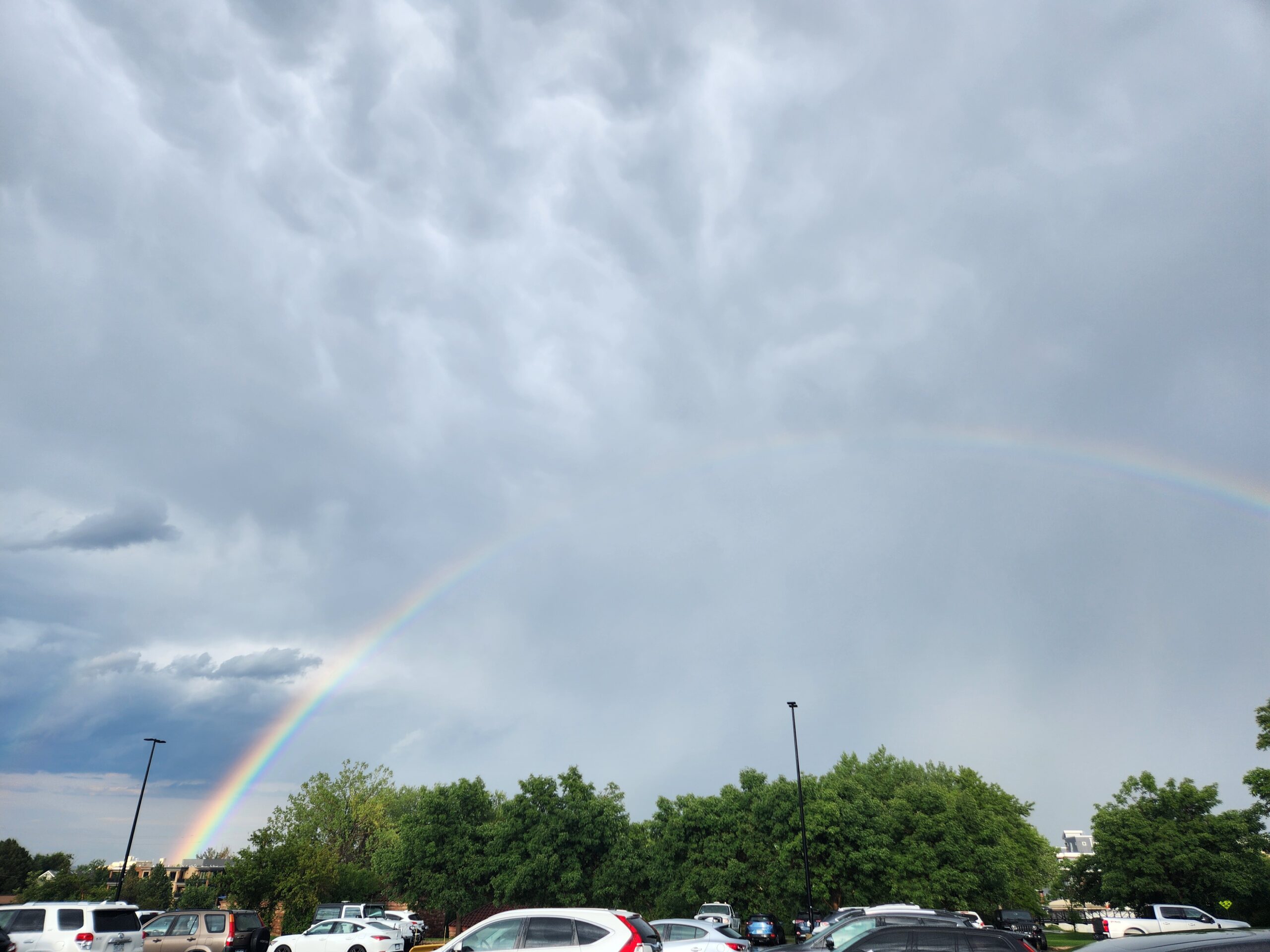
This photo was taken near the Engineering Center, in parking lot 436, facing east, around (40, -105.26).
In the image, several different cloud types can be observed. The lower-left region likely shows Cumulonimbus clouds, while the upper part has Mammatus clouds, which are characteristic features beneath a thick Cumulonimbus anvil layer. In the upper-right and middle parts, there are Stratus or Altostratus clouds that may be the outer, spreading portions of the cumulonimbus system.These clouds indicate an unstable atmosphere, where strong vertical motion, moisture gradients, and turbulence occur due to convective activity.
1 Comment. Leave new
The mammatus under the anvil is super clear, and that thicker base on the lower left definitely looks like a cumulonimbus core. The surrounding stratus/altostratus sheets make sense as the outflow spreading from the storm. Definitely reads like a convectively active, unstable setup.