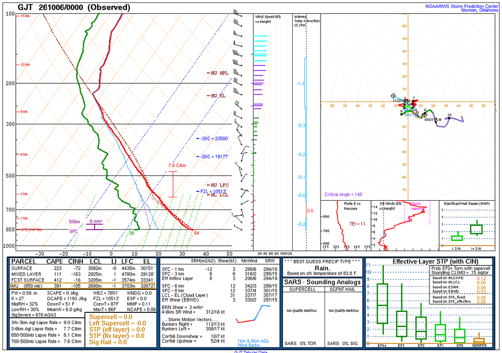
This image was taken facing west, at around 5:27PM on October 5th, 2026 from approximately 1,450 ft. west of the intersection between Cherryvale and South Boulder Road. I suspect the bright clouds present to be cirrus clouds, given the tendril-like structures. The radial pattern distinguishes them from cirrostratus, to my understanding, as it implies these are a form of anvil head created as rising clouds met the troposphere. From the skew-T diagram given below, I would estimate these to have been at an altitude between 29000 ft. and 32900 ft. given the EL altitudes provided in the table at the bottom. Within this region, the atmosphere transitioned to being stable from unstable, and I would place these clouds in the stable region.
The Skew-T Log-P diagram shown below was provided by NOAA and was produced for October 6th UTC-0000, corresponding to 6:00PM MDT on October 5th (within 40 minutes of the time my image was taken).