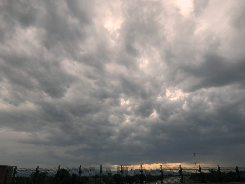
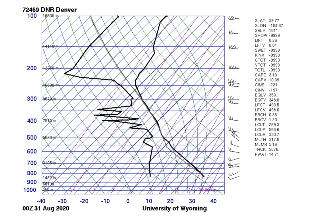
This image was taken while walking on a bridge on August 31st, 2020 in Denver, CO. I believe these are stratocumulus clouds because you can tell this is a thin layer of clouds and it almost seems like a blanket which makes me think it is flat. Another reason I believe they are stratocumulus is because of the CAPE value on the skew-t diagram; the value is 3.1 which is super close to zero which means the atmosphere is pretty stable.
Cloud Image: Stratocumulus
Categories
Search for content or authors
Flow Vis Guidebook
- Particles 2: Aerosols - Under Construction
- Introduction to the Guidebook
- Overview 1: Phenomena. Why Does It Look Like That?
- Overview 2: Visualization Techniques
- Overview 3: Lighting
- Overview 4 - Photography A: Composition and Studio Workflow
- Overview 4 - Photography B: Cameras
- Overview 4 - Photography C: Lenses - Focal Length
- Overview 4 - Photography C: Lenses - Aperture and DOF
- Overview 4: Photography D: Exposure
- Overview 4 - Photography E - Resolution
- Overview 5 - Post-Processing
- Clouds 1: Names
- Clouds 2: Why Are There Clouds? Lift Mechanism 1: Instability
- Clouds 3: Skew - T and Instability
- Clouds 4: Clouds in Unstable Atmosphere
- Clouds 5: Lift Mechanism 2 - Orographics
- Clouds 6: Lift Mechanism 3 - Weather Systems
- Boundary Techniques - Introduction
- Dye Techniques 1 - Do Not Disturb
- Dye Techniques 2 - High Visibility
- Dye Techniques 3 - Light Emitting Fluids
- Refractive Index Techniques 1: Liquid Surfaces
- Refractive Index Techniques 2: Shadowgraphy and Schlieren
- Particle Physics: Flow and Light
- Art and Science
- TOC and Zotpress test
- Photons, Wavelength and Color
2 Comments. Leave new
I really like how the clouds fill up the whole sky. It makes me think there was a huge storm happening at the time this image was taken.
I love the dark clouds with the little bits of light coming through. This is definitely a really cool photo!