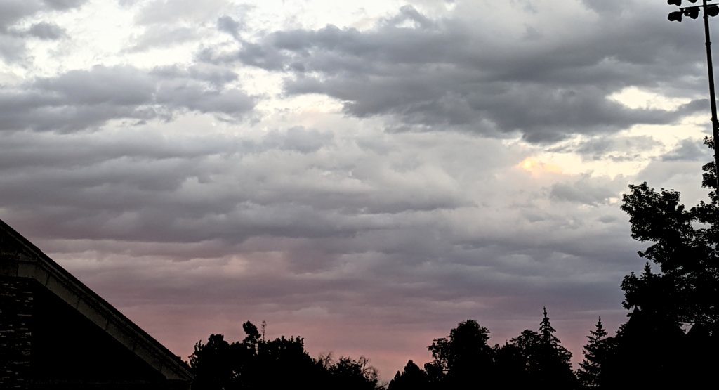
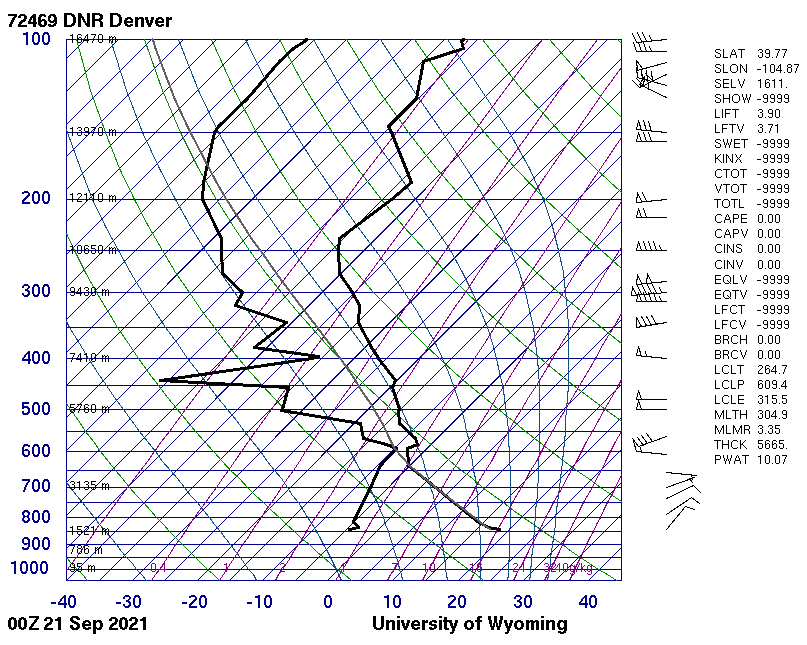
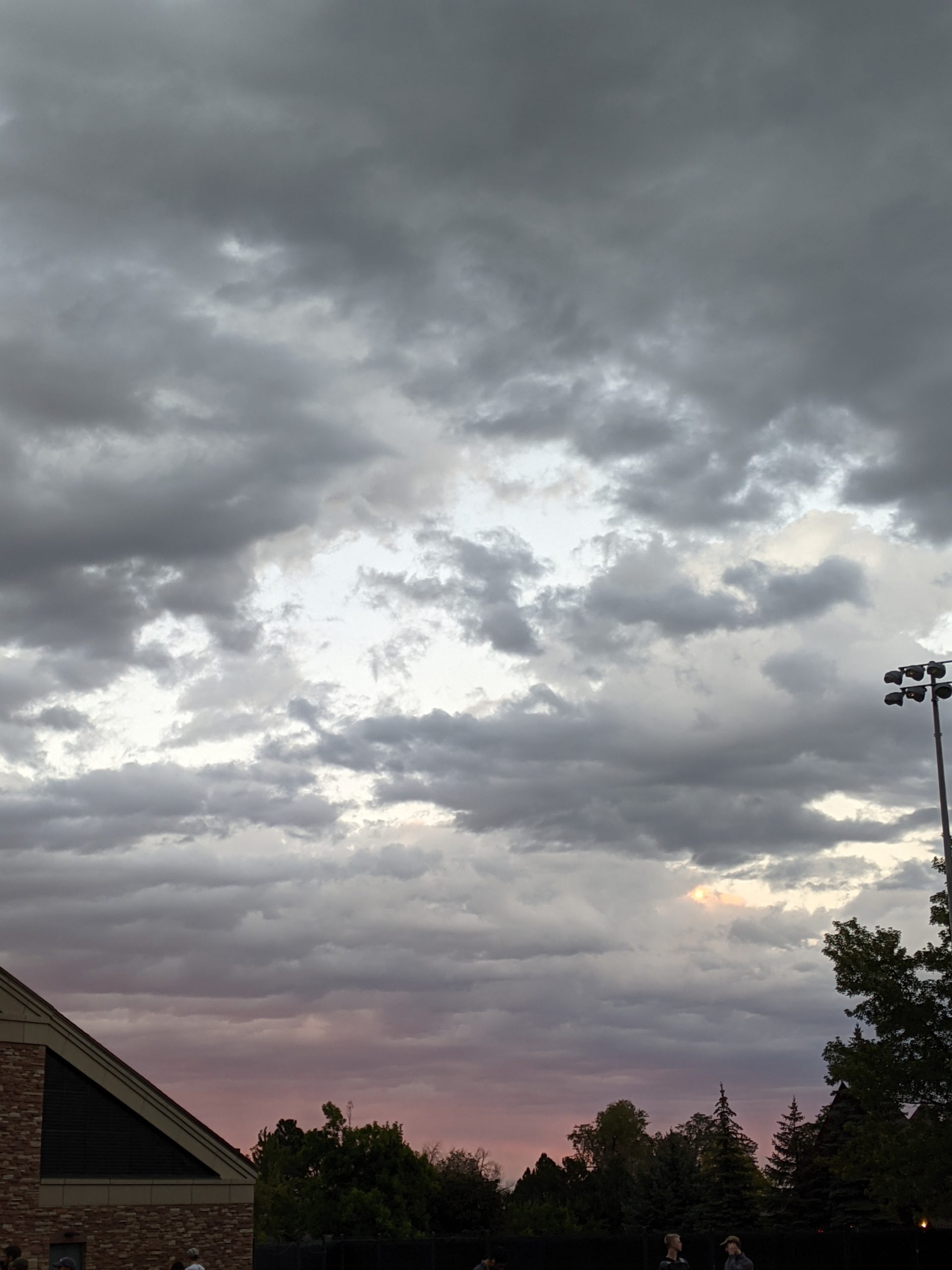
I took this photo on September 20th around 6pm in Boulder. The sunset that night was stunning, and I noticed that the clouds created a rolling blanket at a constant altitude. This blanket of clouds seemed to be low altitude and clouds were not moving around. I predict that these clouds were stratus clouds covering most of the Colorado front range. Looking at the Skew-T diagram, I see around the 4000 m altitude mark, the dew point and temperature lines are very close. This suggests that the air around 4000m is condensation into clouds. Also, at this altitude the parcel lapse rate is at a lower temperature than the dew point meaning that the temperature of a parcel of rising air would drop below the dew point and condensate into a cloud. This suggests that the blanket of clouds I saw on September 20th were at an altitude of about 4000 m. The CAPE value is 0.00 suggesting that the atmosphere is in a stable spot. Another interesting note is on the Skew-T diagram, the wind direction flips at 4000 m and the speed of the wind below 4000 m is very low. This could create a shear layer at 4000 m and cause atmospheric instability by drawing upward through the shear layer.